


10. Waterfall Island on Iguazu Falls, Brazil
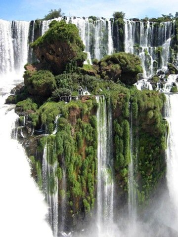
This stunning rock formation is located at Iguazu Falls. Apparently this particular view can be seen from the lookout on San Martin Island on the Argentinian side of the falls. Iguazu Falls are waterfalls of the Iguazu River located on the border of the Brazilian State of Parana and the Argentine Province of Misiones. The falls divide the river into the upper and lower Iguazu. The Iguazu River originates near the city of Curitiba. It flows through Brazil for most of its course. Below its confluence with the San Antonio River, the Iguazu River forms the boundary between Brazil and Argentina. The total height of the falls is about 60-82 meters (200-269 ft). There are approximately 275 different drops and the total width of the falls is a staggering 2.7 kilometers (1.7 miles).
9. Geothermally Active Area, Northeastern Iceland
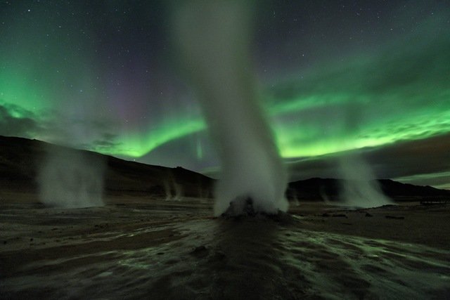
This is not a shot of an alien planet. This was shot on the dark and stormy night of September 12 at Hverir, a geothermally active area along the volcanic landscape in northeastern Iceland. Ghostly towers of steam and gas venting from fumaroles danced against the eerie greenish light of Aurora Borealis.
8. Coral garden, Lizard Island, Great Barrier Reef
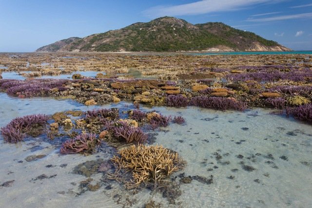
Lizard Island is Australia’s northernmost island resort. It is located 150 miles north of Cairns and 57 miles north east off the coast from Cooktown. Lizard Island is an absolute tropical paradise, a haven of isolation, gratification and relaxation. The above picture of the coral garden was shot during one of its lowest tide.
7. Melissani Cave, Kefalonia Island, Greece
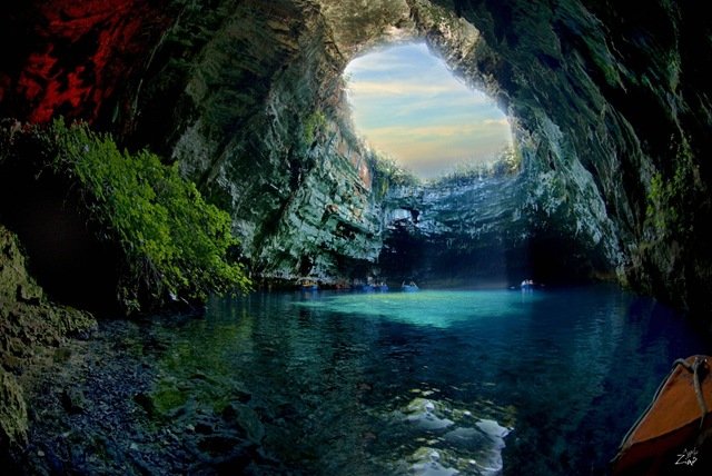
Located on the Kefalonia Island in Greece, this spectacular cave was lost for centuries until being rediscovered in 1951 by Giannis Petrocheilos. Take a look at this beautiful cave system and the island that it is part of. The famous Mytros Beach is also on this island.
6. Sea cave in Algarve, Portugal
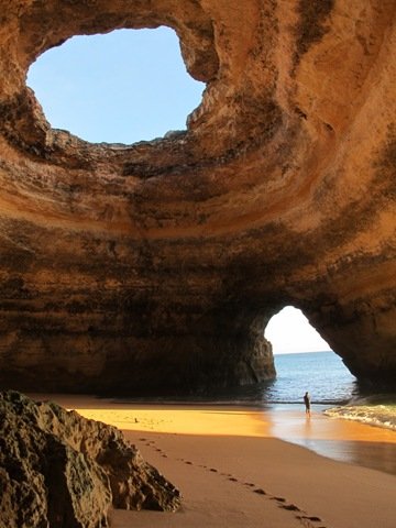
Sea caves are found throughout the world, actively forming along coastlines. A sea cave, also known as a littoral cave, is a type of cave formed primarily by the erosive wave action of the sea.
5. Namib Desert
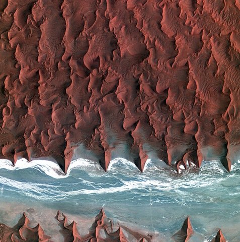
Korea’s Kompsat-2 satellite captured this image over the sand seas of the Namib Desert on 7 January 2012. The Namib is the oldest desert in the world, stretching over 2000 km along Africa’s southwestern coast from Angola, through Namibia to South Africa. Sand dunes dominate the desert – some reaching over 300 m in height. The blue and white area is the dry river bed of the Tsauchab – which only sees water following rare rainfall in the Naukluft Mountains to the east. Black dots of vegetation are concentrated close to the river’s main route, while salt deposits appear bright white. This flattened area ends about 15 km to the east at the Sossusvlei salt and clay pan (not shown).
4. Morondava, Madagascar
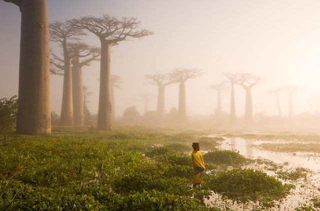
Near the city of Morondava on the west coast of Madagascar lies an ancient forest of baobab trees. Unique to Madagascar, the endemic species is sacred to the Malagasy people, and rightly so. Some of the trees here are over a thousand years old. It is a spiritual place, almost magical.
3. Thousand Islands Lake, China
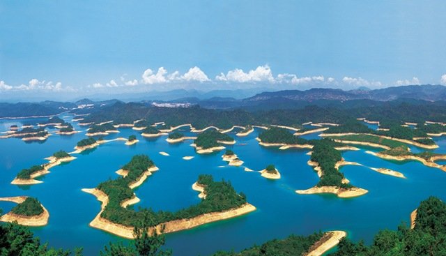
With 81% of the area covered in forests, Thousand Islets Lake (Qian Dao Lake) is a pure lake with clean, fresh air. It is a young lake formed in 1959 as a result of the construction of New Anjiang Hydroelectric Power Station. It is a beautiful lake with 1078 islets showing different views in different seasons. It is a rich lake abounding with fish and surrounded by trees, tea, mulberry (the food of the silkworm) and other fruit trees. Qian Dao Lake is also a delightful lake with many activities including enjoying the natural scenery and local culture, observing wild animals and taking part in many exciting activities.
2. Turquoise Ice, Northern Lake Baikal, Russia
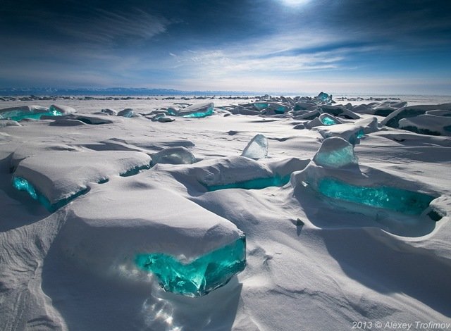
Lake Baikal, located in the southern part of eastern Siberia in Russia, is an incredible natural wonder of the world that one can only hope to visit at least once in their lifetime. It’s not just the oldest freshwater lake on Earth, at 20 to 25 million years old, it’s also one of the largest and deepest, holding an astounding one-fifth of the world’s freshwater. In the winter, for about five months or from January to May, the lake freezes over but the water is so clear that, from the surface, you can see an astounding 130 feet below you. A photographic worthy natural phenomenon occurs around a very specific time of year, March. Wind, temperature differences, frost and sun in the ice crust cause cracks and ice hummocks to form. Transparent and shining in a turquoise color, these masses of broken ice look like shards of glass rising into the sky. They are caused by the slow and unequal pressure in the main body of the packed ice as well as by the unequal structure and temperature.
1. The Flatirons, Boulder, Colorado
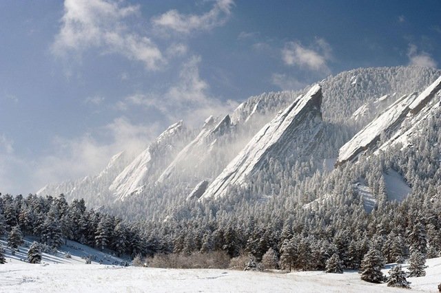
The Flatirons are remnants of the Fountain Formation, a feldspar-rich sand eroded from the ancestral Rocky Mountain uplift 300 million years ago. Sediments deposited by inland oceans compressed this layer into sandstone, thrust upward 45 million years ago by the same forces that created our modern Rocky Mountains. Water, wind, and mechanical erosion have since shaped these exposed rocks into the angular formations we see today.