


10. Oneonta Gorge, Oregon, USA
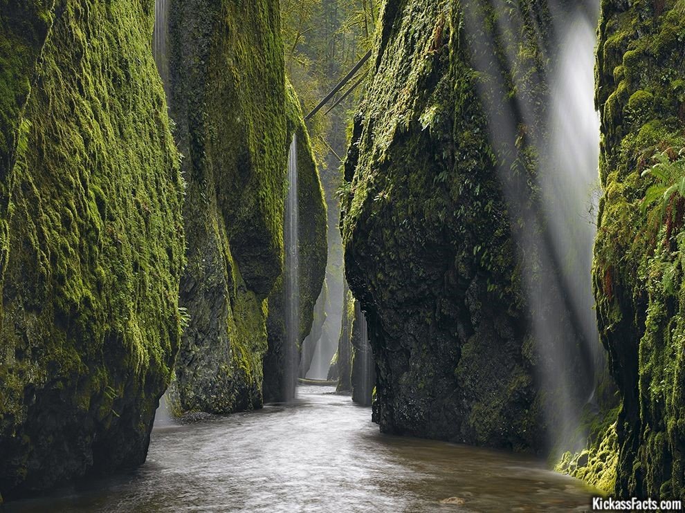
Oneonta Gorge is one of those hidden treasures that you just have to see to believe. Tucked away within the stunning Columbia River Gorge (which is a natural wonder all on its own), this magical creek might be one of America’s most beautiful hikes. It was a miner ’49er named Carleton Eugene Watkins, originally on the West Coast for the California gold rush, who first photographed the area, and he was the one who gave the gorge its name– he called it “Oneonta” after his hometown of Oneonta, New York.
Just fair warning– if you do plan on hiking through the enchanting gorge, be prepared to get wet; at times the stream itself is the actual trail, taking you past enormous basalt walls covered in emerald green moss and bubbling, sparkling waterfalls. The lower gorge is a protected habitat for the rarest lichens and ferns and wildlife, hence the need to walk upstream through the creek. There are four major waterfalls along the gorge (Upper Oneonta Falls, Middle Oneonta Falls, Lower Oneonta Falls and the triple falls), so the hike, which at times can be through chest-deep water, is totally worth it. If you’d rather not get wet while exploring Oneonta, don’t sweat– there are also trails and observation decks and bridges on dry land through other parts of the verdant gorge, so people of all hiking skill levels can experience it for themselves.
9. Mormon Row Meadow, Grand Teton National Park, Wyoming

Mormon Row is a line of homestead complexes along the Jackson-Moran Road near the southeast corner of Grand Teton National Park, in the valley called Jackson Hole. The rural historic landscape’s period of significance includes the construction of the Andy Chambers, T.A. Moulton and John Moulton farms from 1908 to the 1950s. Six building clusters and a separate ruin illustrate Mormon settlement in the area and comprise such features as drainage systems, barns, fields and corrals. Apart from John and T.A. Moulton, other settlers in the area were Joseph Eggleston, Albert Gunther, Henry May, Thomas Murphy and George Riniker.
8. Twelve Apostles, Australia

One of the most well-known highlights of the Great Ocean Road is The Twelve Apostles. Situated in the Port Campbell National Park, the massive limestone structures that tower 45 meters above the tempestuous Southern Ocean, leave its visitors awe-struck in wonder at their size and beauty. Behind the eight remaining stacks (five have fallen since their discovery) are majestic cliffs, around 70 meters high.
Glorious at both dusk and dawn the Twelve Apostles, by the forces of nature has gradually eroded the softer limestone, forming caves in the cliffs which became arches and when they collapsed, rock islands as high as 45 meters were left isolated from the shore.
7. Shigar, Skardu, Pakistan
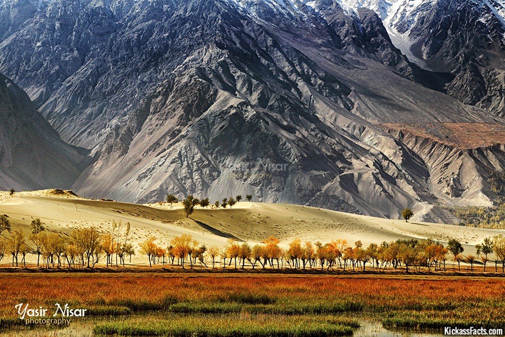
Image: Grassland, sandy desert, rocky cliffs and snowcapped mountains all in one frame. Shigar, Skardu, Pakistan
Shigar Valley is a valley in Baltistan in northern Pakistan that is watered by Shigar River. The valley stretches about 170 km from Skardu to Askole and is the gateway to the high mountains of the Karakoram. Even though the Shigar Valley is a remote and largely inaccessible place, there are several villages in the valley
6. Mt. Kilimanjaro, Tanzania
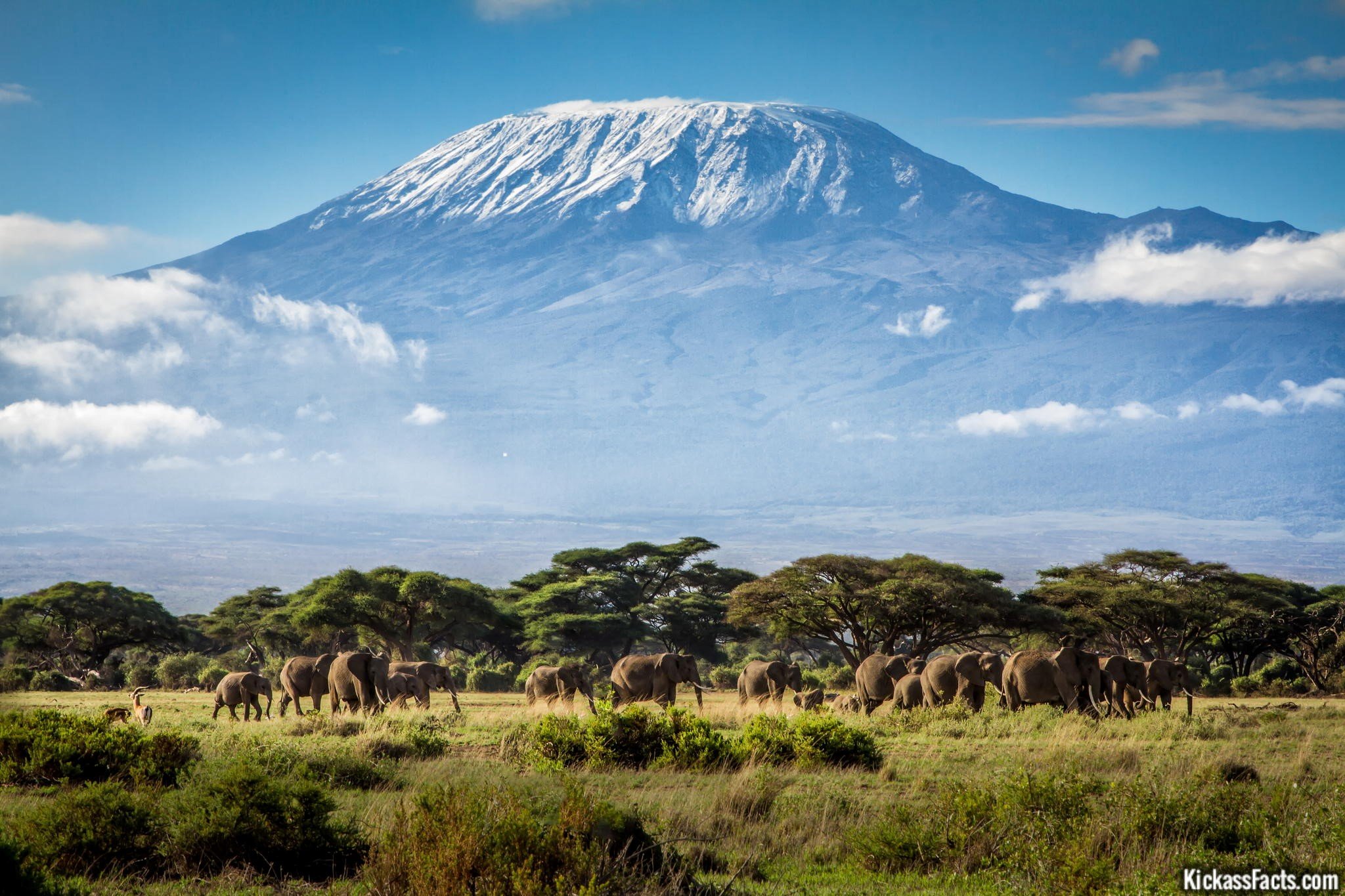
Kilimanjaro, by any name, is a metaphor for the compelling beauty of East Africa. When you see it, you understand why. Not only is this the highest peak on the African continent; it is also the tallest free-standing mountain in the world, rising in breathtaking isolation from the surrounding coastal scrubland – elevation around 900 metres – to an imperious 5,895 metres (19,336 feet).
Kilimanjaro is one of the world’s most accessible high summits, a beacon for visitors from around the world. Most climbers reach the crater rim with little more than a walking stick, proper clothing and determination. And those who reach Uhuru Point, the actual summit, or Gillman’s Point on the lip of the crater, will have earned their climbing certificates.
But there is so much more to Kili than her summit. The ascent of the slopes is a virtual climatic world tour, from the tropics to the Arctic. Even before you cross the national park boundary (at the 2,700m contour), the cultivated footslopes give way to lush montane forest, inhabited by elusive elephant, leopard, buffalo, the endangered Abbot’s duiker, and other small antelope and primates. Higher still lies the moorland zone, where a cover of giant heather is studded with otherworldly giant lobelias.
Above 4,000m, a surreal alpine desert supports little life other than a few hardy mosses and lichen. Then, finally, the last vestigial vegetation gives way to a winter wonderland of ice and snow – and the magnificent beauty of the roof of the continent.
5. Skeleton Coast, Namibia
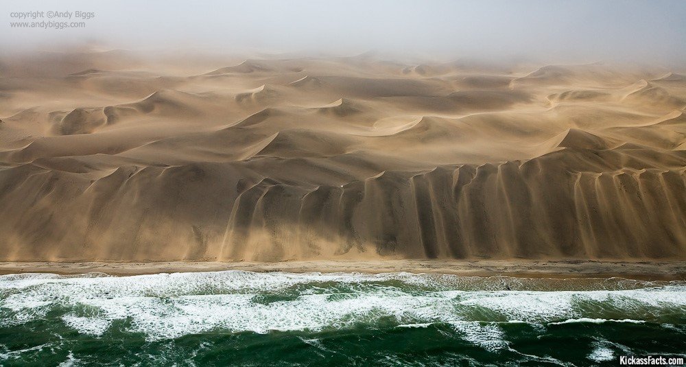
A barren stretch of shore in Namibia maintains a reputation as one of the harshest places on earth…and it has an ominous name to match. The Skeleton Coast owes its appellation to the whalebones that peppered the shoreline when the whaling industry was booming, as well as, more ominously, to the hulking carcasses of sea-wrecked ships buried in the sand and disintegrating in the water—more than 1,000 have met their end on the deadly coast.
But Skeleton Coast isn’t even the region’s most foreboding title. First encountered by daring Portuguese explorers in the 15th century, the region was dubbed “The Gates of Hell” because of its harsh conditions. Locally, Namibia’s Bushmen tribes know it as “the land God made in anger.”
4. Manly Beach, Sydney, Australia
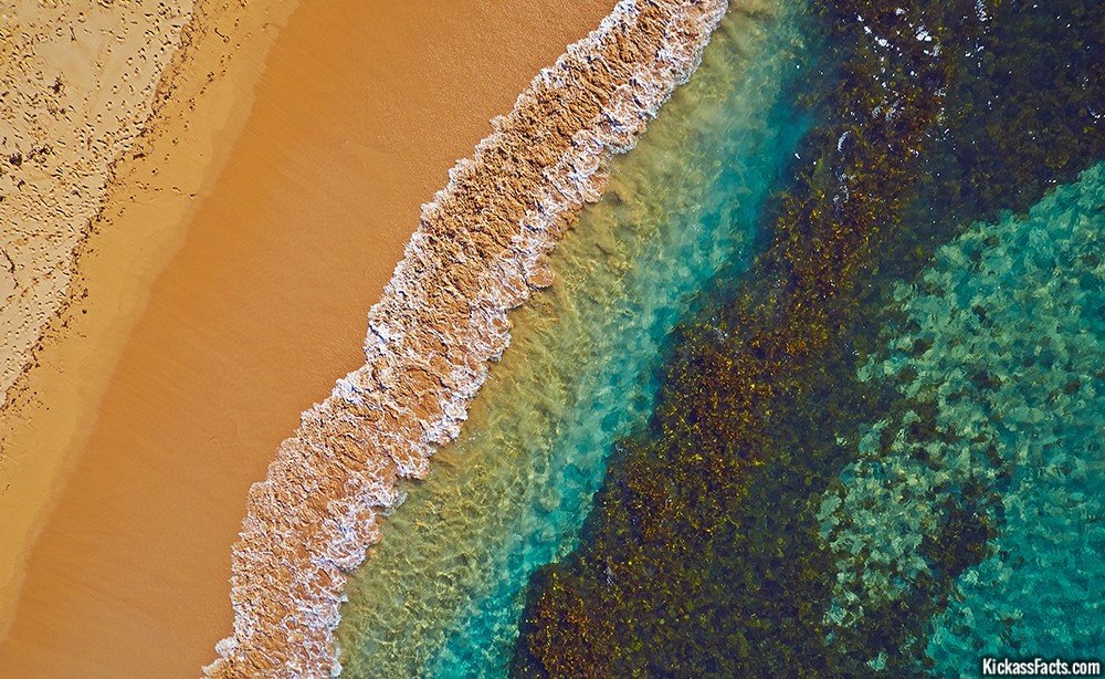
Image: Water and sand mix to create ocean rainbow, Manly Beach, Sydney, Australia. By Remy Gerega
Manly Beach is a beach situated among the Northern Beaches of Sydney, Australia in the city of Manly. From north to south, the three main sections are Queenscliff, North Steyne, and South Steyne.
The beach was named by Capt. Arthur Phillip for the indigenous people living there. Philip wrote that “[the indigenous people’s] confidence and manly behaviour made me give the name of Manly Cove to this place.”
3. Perito Moreno Glacier, Argentina
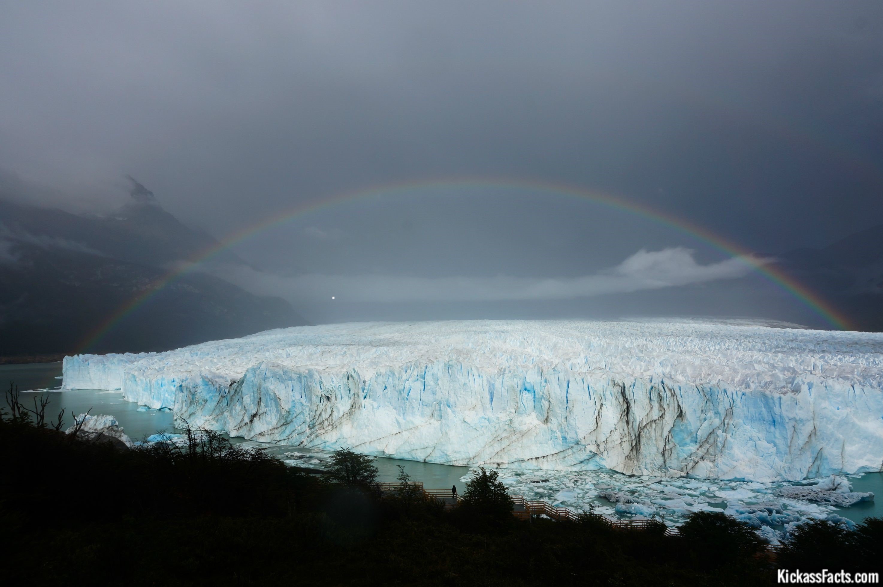
Los Glaciares National Park is located in the area known as Austral Andes in Argentina, in the south west of Santa Cruz on the border with Chile. Due to its magnificent natural beauty, it constitutes a wonder in the world, and was declared “World Heritage” by UNESCO in 1981.
On the southern area of the Park, the most famous glacier can be seen: Perito Moreno. It is very famous because of its dynamic changes, which produces a cyclic phenomenon of forward and backward movement, with spectacular ice falls from its front walls. The closest town is El Calafate.
2. The Devil’s Teeth, Senja, Norway
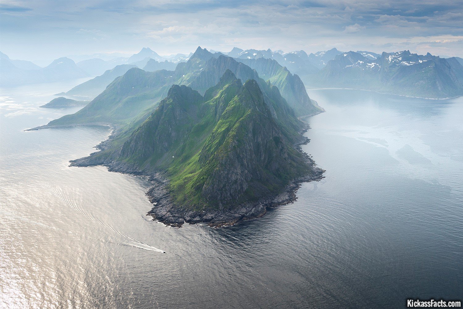
On the seaward coast of Senja, the ocean meets sheer cliffs running down from steep mountainsides, skerries and breathtaking views, and Okshornan is the most popular place for photos. Senja National Tourist Route offers ramps down to the sea.
1. Kenai Fjords National Park, Alaska

Created in 1980 to protect some of the most incredible and impenetrable wilderness in Alaska, Kenai Fjords National Park is a 601,839-acre glaciated paradise lying at the foot of Seward. Snow and ice cover 60 percent of the park and crowning it is the 936-square-mile Harding Icefield, one of only four remaining icefields in the U.S. From the massive icefield countless tidewater glaciers pour down, carving valleys that fill with seawater to form the stunning fjords that the park is named after and then decorating them with icebergs the size of small houses.
With such a landscape and an abundance of marine wildlife the park has become a major tourist attraction. As far as visitors are concerned Kenai Fjords has three main areas – Exit Glacier, Harding Icefield and the rugged coastline with the beautiful tidewater glaciers. The easiest to reach is the road-accessible Exit Glacier which explains why it’s the park’s most popular attraction, easily drawing more than 100,000 visitors each summer. Hardier souls can ascend to views of the Harding Ice Field from a trail at Exit Glacier and experienced mountaineers equipped with skis, ice axes and crampons can continue on to explore the largest icefield that lies entirely within U.S. borders.